搜索结果: 1-15 共查到“工学 Monitoring System”相关记录49条 . 查询时间(0.125 秒)

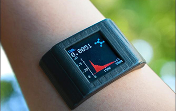
Adhesive film turns smartwatch into biochemical health monitoring system(图)
Adhesive film turns smartwatch into biochemical health monitoring system
2020/7/3
Engineers funded by the National Science Foundation and affiliated with UCLA have designed a thin adhesive film that could upgrade a consumer smartwatch into a health-monitoring sy...
CONSTRUCTION OF GREEN TIDE MONITORING SYSTEM AND RESEARCH ON ITS KEY TECHNIQUES
green tide GIS remote sensing integration spatial distribution extraction
2018/5/16
As a kind of marine natural disaster, Green Tide has been appearing every year along the Qingdao Coast, bringing great loss to this region, since the large-scale bloom in 2008. Therefore, it is of gre...
A STUDY ON REAL-TIME FLOOD MONITORING SYSTEM BASED ON SENSORS USING FLOOD DAMAGE INSURANCE MAP
Monitoring System Flood Damage Insurance Map IoT (Internet of Things) LPWA (Low Power Wide Area)
2018/4/18
Typical types of natural disasters that occur in Korea are damages from heavy rain, storm, and heavy snow. In order to prepare for this, the storm and flood damage insurance program is operated. For t...
A STUDY ON REAL-TIME FLOOD MONITORING SYSTEM BASED ON SENSORS USING FLOOD DAMAGE INSURANCE MAP
Monitoring System Flood Damage Insurance Map Internet of Things LPWA
2018/5/8
Typical types of natural disasters that occur in Korea are damages from heavy rain, storm, and heavy snow. In order to prepare for this, the storm and flood damage insurance program is operated. For t...
ACCURACY ASSESSMENT OF A UAV-BASED LANDSLIDE MONITORING SYSTEM
Landslides UAV structure-from-motion georeferencing bundle adjustment DEM
2016/11/11
Landslides are hazardous events with often disastrous consequences. Monitoring landslides with observations of high spatio-temporal resolution can help mitigate such hazards. Mini unmanned aerial vehi...
TOWARDS A LOW-COST, REAL-TIME PHOTOGRAMMETRIC LANDSLIDE MONITORING SYSTEM UTILISING MOBILE AND CLOUD COMPUTING TECHNOLOGY
Structure-from-Motion (SfM) close range photogrammetry mobile device cloud computing landslide monitoring system
2016/11/11
Close-range photogrammetric techniques offer a potentially low-cost approach in terms of implementation and operation for initial assessment and monitoring of landslide processes over small areas. In ...
A WILDLIFE MONITORING SYSTEM BASED ON TIANDITU AND BEIDOU: IN CASE OF THE TIBETAN ANTELOPE
Tianditu Beidou GPS,Wildlife Monitoring Realtime
2016/11/8
Positioning and tracking wildlife is already being an effective way to collect biological information for research and species of wildlife protection. The common technologies of tracking wildlife are ...
Construction of Sacramento Kings arena using award-winning drone monitoring system developed at Illinois
Sacramento Kings arena drone monitoring system Illinois
2016/3/11
A University of Illinois team has developed predictive visual data analytics tools, called "Flying Superintendent" to automate and streamline today’s time-consuming practices for construction progress...
Near real time airborne monitoring system for disaster and traffic applications
Aerial cameras image series near real time processing traffic parameter extraction direct georeferencing emergency response middleware
2016/1/25
A near real time airborne monitoring system for monitoring of natural disasters, mass events, and large traffic disasters was
developed in the last years at the German Aerospace Center (DLR). This s...
A GLOBAL CROP GROWTH MONITORING SYSTEM BASED ON REMOTE SENSING
Remote Sensing global crop growth monitoring system
2016/1/3
Crop growth means the growth of cereal crop seedlings, as well as the status and trend of their growth. It has been one of the most important aspects of agricultural remote sensing in the last twenty ...
AMAZON DEFORESTATION MONITORING SYSTEM WITH ALOS SAR COMPLEMENTARY DATA
Environmental monitoring SAR Radar Real-Time
2015/12/28
Deforestation monitoring for the Brazilian Amazon has been carried on by INPE since 1988, under the PRODES program, and recently, the DETER was created for faster response. The data from both programs...
THE USE OF REMOTE SENSING WITHIN THE MARS CROP YIELD MONITORING SYSTEM OF THE EUROPEAN COMMISSION
Remote Sensing Agriculture Meteorology Indicators Multisensor Multitemporal
2015/12/28
The objective of the Mars Crop Yield Forecasting Systems (MCYFS) is to provide precise, scientific, traceable independent and timely forecasts for the main crops yields at EU level. The forecasts and ...
FUNCTIONING OF FIRE AND FLOOD SPACE MONITORING SYSTEM IN KAZAKHSTAN
Space Images Fire Space Monitoring Flood Space Monitoring Operating Mapping Zones of High Fire Risk Flood risk Zones Dynamics of Filling of Water Reservoir
2015/12/28
The brief description of system of space monitoring of extreme situations in Kazakhstan, consisting of system of space monitoring of fires and system of space monitoring of flooding is given. Results ...
UAV BASED MONITORING SYSTEM AND OBJECT DETECTION TECHNIQUE DEVELOPMENT FOR A DISASTER AREA
Hazards Developing Countries Monitoring Semi-automation Extraction Software
2015/12/28
In the case of natural hazards the spatial extent of the disaster area is usually large. It is often difficult to conduct search and rescue operations from the ground. Such operations are often hinder...
CONCEIVING AND DESIGN OF COALFIELD FIRE AREA DYNAMIC MONITORING SYSTEM IN CHINA
Hazards Environment Application Monitoring GIS
2015/12/28
According to the guiding idea of " digital fire area " stratagem, with GIS working method transpierced in overall process of system construction, the coalfield fire area monitoring system based on net...

